Doi Nangmo (ดอยนางเมาะ) — located near Pa Haen Reservoir in Mae On District, Chiang Mai — is not just another “easy” touristy trek but for the adventurous offers amazing views and a unique hiking experience in Chiang Mai. Clocking in at around 8 km (loop) and involving ropes, narrow ridgelines, and exposed sections, it demands strong fitness, secure footing, and solid route-reading skills. This post is built around practical, actionable advice—no fluff—so you can plan, prepare, and execute the hike with clarity.
Getting to the Trailhead
Location: The trailhead is in Mae On District, near Ban Mae Pha Haen village. It begins close to the Pa Haen Reservoir.
Driving from Chiang Mai:
Take Highway 1317 eastbound from the city toward San Kamphaeng and continue toward Mae On.
Turn off near the reservoir; the trailhead is located on a small dirt road just before the water.
Travel Time: Approximately 40–50 minutes from Chiang Mai’s Old City by car or motorbike.
Parking: A small open area near the reservoir serves as the parking spot. There are no facilities, restrooms, or shops at the trailhead. There are arrows nailed to trees to mark the trail.
Public Transport: Not viable for this hike. Private vehicle or motorbike is required.
Trail Overview and Main Challenges
The Doi Nangmo trail can be completed either as a loop of approximately 8 kilometers or as an out-and-back route of about 5 kilometers, depending on which track you follow. The total elevation gain is roughly 500 meters, most of which occurs in a relatively short and steep ascent phase. For most hikers, the full route will take around three to three and a half hours to complete, including breaks.
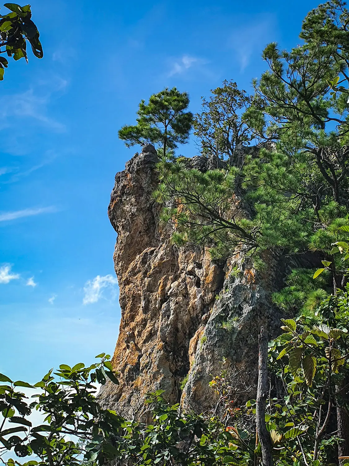
One of the main challenges of this hike is a short but exposed roped section. This part involves using a fixed rope to climb or descend a vertical rock face of around two to three meters. While it’s not technical climbing, it does require confidence, balance, and the ability to support your own weight. There are also other steep and slippery parts of the trail, especially if conditions are wet.
The terrain varies from narrow dirt paths to loose gravel and rocky sections. Vegetation can also obstruct parts of the trail during the rainy season. There are no trail signs or direction markers, so hikers must rely on GPS tools or downloaded maps. Anyone attempting the hike should be prepared for basic route-finding without assistance.
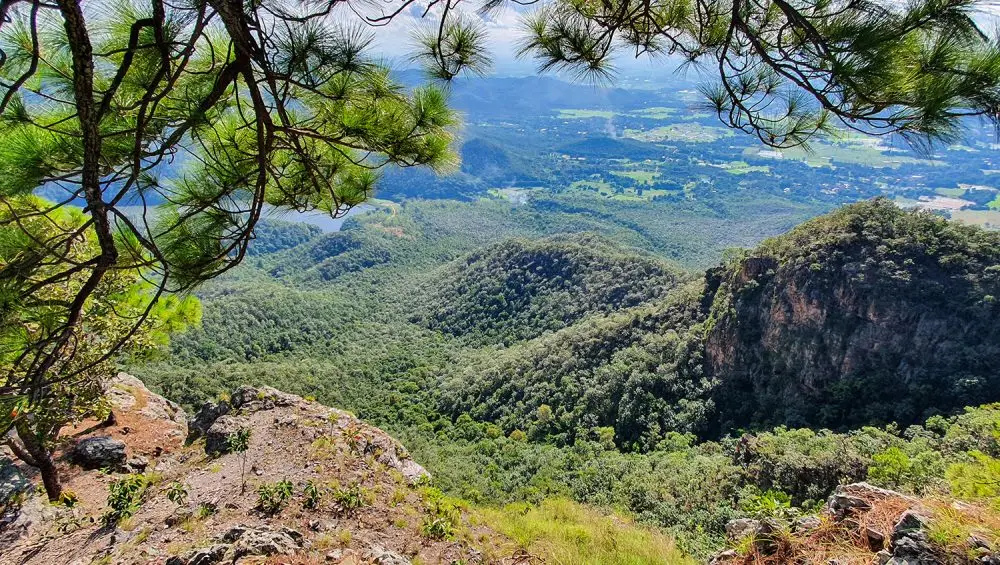
Finally, the trail includes exposed ridgelines where caution is required, particularly during windy or wet conditions. The combination of steep climbs, slippery ground, and minimal signage makes this a physically and mentally demanding hike that should not be underestimated.
The hike begins near the Pa Haen Reservoir in Mae On District. Just before you reach the resevoir from the west, a dirt road is on the left side leading into the forest. The first part of the trail is straightforward, with a gradual incline along quite a wide path.
After approximately one kilometer, the trail begins to steepen significantly. The forest becomes denser, and the path climbs continuously. There are no signs other than the odd arrow nailed to a tree, so staying on course requires checking your GPS frequently and ignoring misleading side tracks.
As you approach the ridgeline, you’ll come to the most technical part of the hike — a short, steep rock face with a fixed rope installed. This section is only a few meters high but should be approached with caution. You’ll need to use both hands to pull yourself up or lower yourself down, depending on your direction. If the rock is wet or muddy, this part can be slippery and significantly more dangerous.
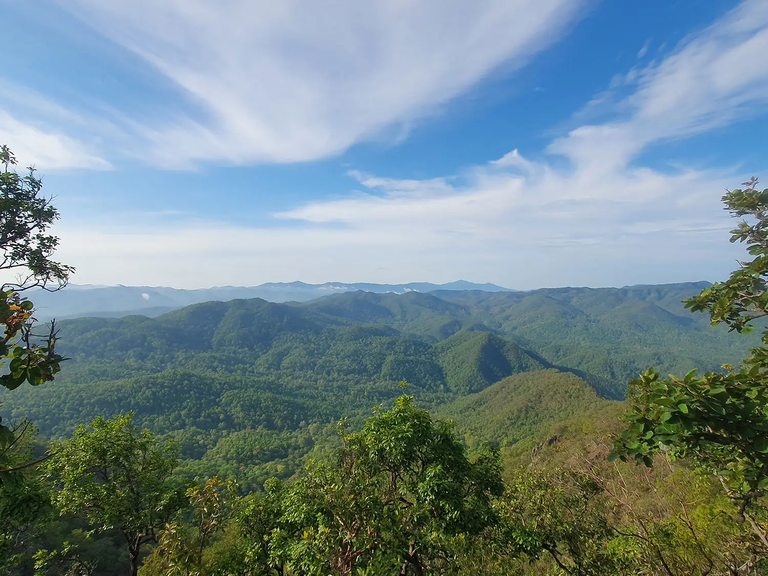
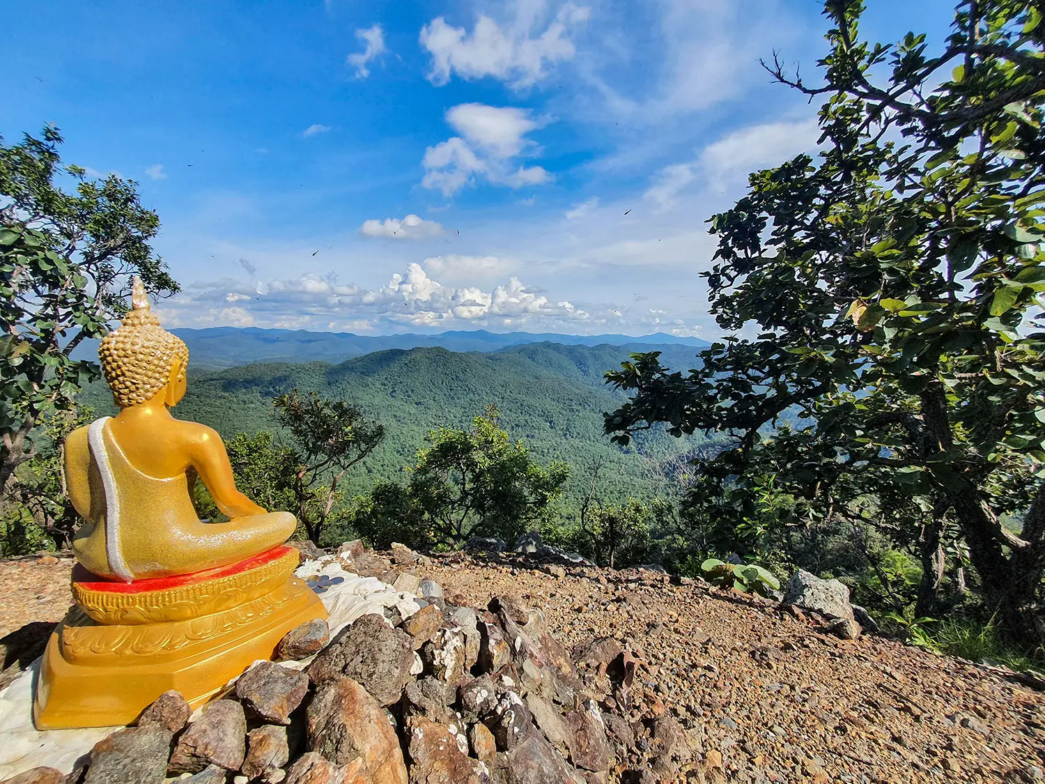
After the rope section, the trail levels out briefly along a narrow ridge before reaching the summit. The top is marked by a small clearing, and although there may be limited views due to vegetation, it serves as a good rest point. The views are really spectacular along this section.
The descent follows the same route if you’re doing an out-and-back hike. If completing the full loop, the trail continues down the opposite side of the ridge through more forest, eventually reconnecting with a paved road near the reservoir. This return section is easier to follow but still requires caution due to uneven ground and slippery patches during wet conditions. There is a second roped section down a steep section of trail however you’ll only need this if wet.
Seasonal Timing and Weather Considerations
The best time to hike Doi Nangmo is during the dry season, which typically runs from November to February. During these months, the weather is cooler, the trail is more stable, and visibility tends to be better. These conditions make it safer and more enjoyable to navigate the steep sections, especially the rope climb and ridge.
From March to May, daytime temperatures rise significantly, and while the trail remains accessible, hiking becomes more physically demanding due to heat. If you plan to go during this time, it’s essential to start early in the morning—ideally before 8:00 AM—to avoid the hottest part of the day.
Hiking is not recommended during the rainy season (June to October). The trail becomes muddy and slippery, especially on the roped section and the steeper parts of the descent. Visibility may also be reduced by fog or heavy cloud cover, and overgrown vegetation can obscure parts of the route. In some years, sections of the trail may be temporarily closed due to safety risks during the rainy season.
Always check the local weather forecast before setting out, and avoid hiking during or after rainfall. Even a short shower can make the terrain significantly more dangerous.
What to Bring
Proper gear is essential for completing the Doi Nangmo hike safely. First and most importantly, you’ll need sturdy hiking footwear with good grip. The trail includes uneven ground, loose gravel, and slick rock surfaces, especially near the rope section.
Navigation tools are mandatory. Since there are no trail markers or signs, you must bring an offline GPS app with a preloaded track. Apps like Gaia GPS, AllTrails, or Maps.me work well in this area. Make sure your phone is fully charged and bring a power bank in case you need to navigate for longer than expected.
Carry at least 2 liters of water, especially in the hotter months. There are no sources of clean water along the trail. Snacks or light food are recommended to maintain energy, particularly for the climb.
Gloves can be helpful for the rope section, especially if the rope is rough or if your grip strength is reduced due to sweat or rain. Also pack a basic first aid kit, including items for cuts, scrapes, or blisters.
Other recommended items include a lightweight rain jacket (especially if hiking during shoulder seasons), insect repellent, a headlamp in case you’re delayed, and a whistle or emergency signal device if hiking solo.
Safety Notes
Hiking Doi Nangmo comes with real risks, and it’s important to take safety seriously. There is no phone signal in most parts of the trail, so you should not rely on calling for help if you get lost or injured. If you choose to hike solo, make sure someone knows your route and expected return time, and only go alone if you are experienced and fully prepared.
The trail is not officially maintained, and sections may become overgrown or eroded depending on the season. The roped section, while short, is the most serious hazard. Take your time on this part, test the rope before committing your weight to it, and do not attempt it if conditions are wet.
Due to the lack of signs or markers, it’s easy to take a wrong turn. Always keep an eye on your GPS, especially at intersections or forks in the path. Side trails, game tracks, or paths made by locals may look well-worn but lead away from the main route. There are many small trails used by locals to forage, these often disappear to nothing so keep checking your gps.
Wildlife encounters are rare but possible. Snakes, insects, and stray dogs have been reported in the area. Remain alert and avoid hiking at dusk or after dark.
In general, this hike should only be attempted by those who are confident in their fitness, their navigation skills, and their ability to manage risk independently. If that’s not you, consider going with a guide or choosing a better-marked alternative trail closer to Chiang Mai. If you’re interested in a guided hike or would like further advice get in touch with us and enjoy one of the best hikes near Chiang Mai city!